
Summer 2008
Mexico to Canada
2,665 miles and many more steps.
Mexico to Canada
2,665 miles and many more steps.
Mt Rainier.
14,411 ft.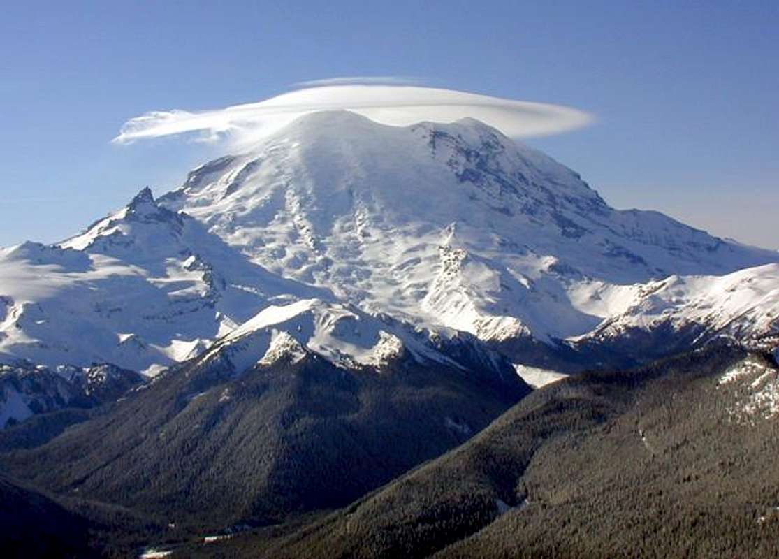 Welcome to the world of glaciers. A peak that could serve to be a stepping stone for, Denali, or eventually Everest.
Need help getting to the top? Wanna climb with a top notch guide?
Rainier Mountaineering Inc. is currently the largest mountain guide service in the US.
They write, "Mount Rainier, at 14,410 feet, is the most extensively glaciated volcanic peak in the continental United States. It offers limitless mountaineering possibilities to both aspiring and experienced mountaineers. The combination of high altitude, various route choices, and Northwest weather make this a truly unique experience."
These guys will guide you to the top and teach all the skills you need along the way for $795. That price will be a 3 day summit trip journey.
Check out Summit Post's Rainier Page for more on the mountain and descriptions of all the routes.
Of course if going to the top is not your think you could consider hiking the Wonderland Trail which is a 93 mile full circle around the mountain. You will probably gain better view's of Rainier than those who actually climb it. Although, those on top may have better view's of everything else.
 Guide to The John Muir Trail
This is the only guide book you will need to get all in the info on hiking the trail you could look for. It includes topo maps of the whole trail, which would usually be more that enough to follow the trail. I have it on the self and would be happy to lend it to any friend thinking of planning a hike.
In late June 2005 my wife of less than a month set out for a southbound hike on the trail. The 2005 summer held an incredible amount of snow, which added whole new levels of excitement to the trip. Constant route finding, extensive ice axe work, collapsing snow bridges, white water roaring streams, and we also got a visit from a Yosemite Bear. More pleasantly crossed over 80 PCT thru-hikers starting in Mexico. Alomost all of them were in our last week, before arriving at Mt. Whitney. Southbound made the best sense for us, crossing PCT hikers, the gradual building to bigger and bigger passes, and with a finish at Whitney I think it is the best way to hike the JMT for anyone.
If you plan on going during early spring in lots of snow, buying the set of special Topo maps could be a MUST. For the JMT you want the Tom Harrison JMT Map Pack. On a previous trip on the PCT in the North Cascades I had sworn to always carry great maps when having to traverse snow which erases the trail. However I didn't learn my lesson well enough. Heading southbound my wife and I were ready to quit and give up after struggling to find the route with all the trail elusively under snow. We still owe the success of our hike to Jewel Thief, the friendly northbound PCTer who graciously passed off his set of the maps he had already walked across. This restored our hope and helped us to finish the trail in that dramatic summer of 2005.
In snow good topos are a must! I think I've learned it.